UNIST site map
- Admissions
-
Academics
- Colleges and Schools
-
Academic Affairs
- Academic Calendar
- Academic Curriculum
- Requirements for Graduation
- Browse Open Courses
- Undergraduate Administration
-
Graduate Academic Affairs
- Tuition Fee Payment
- Academic Leave of Absence/ Academic Return
- Voluntary Withdrawal/ Expulsion
- Change of Major
- Change of Degree Program/ Dropping of Degree Program
- Class Period/ Attendance Period/ Academic Year・Semester
- Course Registration
- Course Drop
- Attendance/ Grade/ Exam
- Credit Transfer/ Credit Carryover
- Academic Forms
- Education Support
-
Research/Industry
- Research Aims
- Research Findings
- Researcher Search
-
Research Organizations
- UNIST Multi-Interdisciplinary Institute
- IBS Research Groups
-
UNIST Labs
- Department of Mechanical Engineering
- School of Energy and Chemical Engineering
- Department of Civil
- Department of Materials Science and Engineering
- Department of Nuclear Engineering
- Department of Industrial Engineering
- Department of Design
- Department of Biomedical Engineering
- Department of Biological Sciences
- Department of Electrical Engineering
- Department of Computer Science and Engineering
- Department of Mathematical Sciences
- Department of Chemistry
- Department of Physics
- School of Business Administration
- Graduate School of Carbon Neutrality
- Graduate School of Artificial Intelligence
- Research Support
- University-Industry Relations
- Campus Life
- News Center
- About UNIST
-
etc
- UNIST Bulletin
- Work-Life Balance Support System
- UNIST Gender Equality Plan
- Faculty Invitation for Tenure Track
- Faculty Invitation for Non-Tenure Track
- Board Meeting Minutes
- University Council Meeting Minutes
- Administrative Service Charter
- Privacy Policy
- Copyright Policy
- Rejection of Unauthorized Email Collection
- Information Disclosure


Connection Points of Knowledge, Everything About UNIST
Try searching.
Recommended search terms


- portal
- U Academics Innovation Center
- Leadership Center
- Dormitory
- Academic Information Center
- International Students Support
- Browse Open Courses
- Course Registration
- Graduation Requirements for Graduation
- Academic Leave of Absence/ Academic Return
- Military Service
- Certificate Issuance
- Academic Calendar
- Scholarships
- Campus Map
- Campus Life Guidebook
- Health Care Center
- Human Rights Center
- portal
- Job Opening
- Announcement for Bid
- UNIST AI Services
- UNIST Daycare Center
- Sports Center
- UI Downloads
- Announcement
- Recruitment of Professors (Non-tenure)
- Faculty Invitation for Tenure Track
- UNIST Academic Information Center
- Office of Research Facilities and Training
- Office of Research Affairs
- Rule Management System
- Academic Calendar
![]()
![]()
This is a collection of menus necessary for UNIST students .
students
- portal
- U Academics Innovation Center
- Leadership Center
- Dormitory
- Academic Information Center
- International Students Support
- Browse Open Courses
- Course Registration
- Graduation Requirements for Graduation
- Academic Leave of Absence/ Academic Return
- Military Service
- Certificate Issuance
- Academic Calendar
- Scholarships
- Campus Map
- Campus Life Guidebook
- Health Care Center
- Human Rights Center
![]()
![]()
This is a collection of menus necessary for prospective UNIST Students .
prospective Students
![]()
![]()
This is a collection of menus necessary for UNIST Faculty & Staff .
Faculty & Staff
- portal
- Job Opening
- Announcement for Bid
- UNIST AI Services
- UNIST Daycare Center
- Sports Center
- UI Downloads
- Announcement
- Recruitment of Professors (Non-tenure)
- Faculty Invitation for Tenure Track
- UNIST Academic Information Center
- Office of Research Facilities and Training
- Office of Research Affairs
- Rule Management System
- Academic Calendar


NEWS CENTER
Discover not only Research Findings and event news, but also the diverse facets of UNIST presented by reporters and writers.
News Center

UNIST News
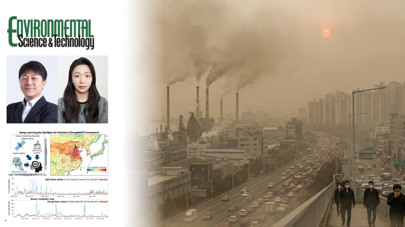
UNIST Unveils AI-Driven Framework for Real-Time Multi-Pollutant Air Quality Monitoring
The findings of this research have been published in Environmental Science & Technology on March 20, 2026.
- Research
- JooHyeon Heo
- 2026.04.10
- 393
Abstract
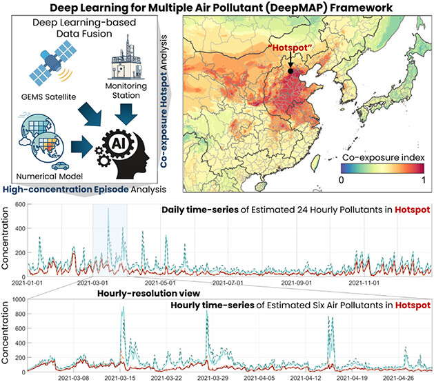
A research team, led by Professor Jungho Im from the Department of Civil, Urban, Earth, and Environmental Engineering at UNIST, has introduced DeepMAP, a cutting-edge artificial intelligence model that accurately estimates hourly levels of six key air pollutants across East Asia. The technology, developed from 2021 to 2023, provides new insights into the widespread and simultaneous exceedance of air quality standards, with significant implications for health policies and environmental management.
DeepMAP integrates diverse data sources—including geostationary satellite imagery, atmospheric chemical transport models, meteorological data, and ground observations—to produce real-time, high-resolution maps of PM10, PM2.5, O₃, NO₂, SO₂, and CO. Operating at a 10 km spatial resolution and providing hourly predictions, the model captures dynamic pollution patterns and hotspots, revealing that Korea experiences about 15 days per year with four pollutants exceeding WHO safety thresholds simultaneously. Unlike traditional methods that estimate pollutants individually, DeepMAP’s multi-task learning approach models interactions among pollutants, significantly enhancing estimation accuracy.

“By accurately capturing the complex interplay of multiple pollutants in real time, our model offers a powerful tool for assessing exposure risks and guiding effective policy decisions,” said Professor Jungho Im, lead researcher. “This represents a major step toward more realistic and comprehensive air quality management.”
The study underscores the health risks posed by combined pollutant exposure, which can worsen respiratory and cardiovascular diseases. Traditional monitoring methods often fall short in providing detailed, regional, and real-time data. DeepMAP’s capabilities open new avenues for environmental monitoring, public health research, and proactive policymaking, especially during pollution episodes driven by seasonal phenomena like dust storms and high-pressure systems.
The findings of this research have been published in Environmental Science & Technology on March 20, 2026. The study has been supported by the National Institute of Environmental Research (NIER) under the Ministry of Environment (ME), and by the National Research Foundation of Korea (NRF), funded by the Ministry of Science and ICT (MSIT).
Journal Reference
Eunjin Kang, Sihun Jung, Jungho Im, et al., "Quantifying Multi-pollutant Co-exposure via Deep Learning-Based Simultaneous Prediction Using Geostationary Satellite Data," Environ. Sci. Technol., (2026).
Related Links
Related Photo


-
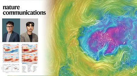
Sea Surface Temperature Shifts in the Pacific Improve Year-Ahead Winter Climate Predictions
-
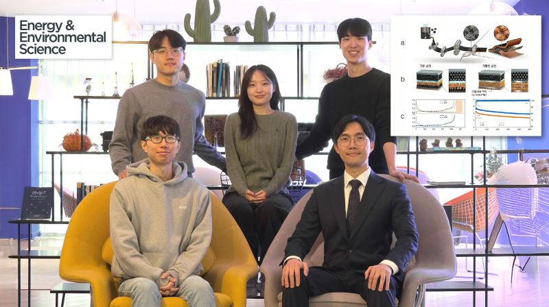
New Study Unveils Atomic Disorder Strategy to Enhance Stability and Efficiency of High-Capacity Batteries
-
New Study Mathematically Defines Key Conditions for Improving AI Model Robustness through Data Augmentation
-
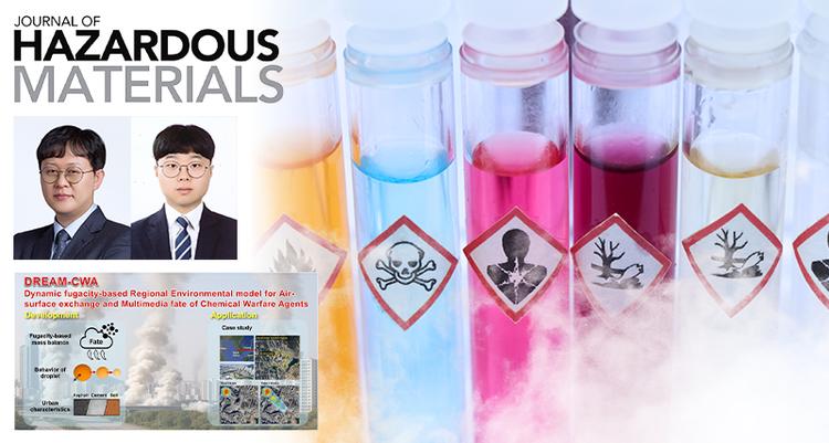
New Simulation Model Provides Accurate Assessment of Urban Spread and Residual Risks of CWAs